The field guide · Scenic trail running
Monsal, Tissington or High Peak Trail: which suits your run?
By James Thompson · Updated 27 October 2026
Some links in my articles are affiliate links. I may earn a commission when you buy through them.
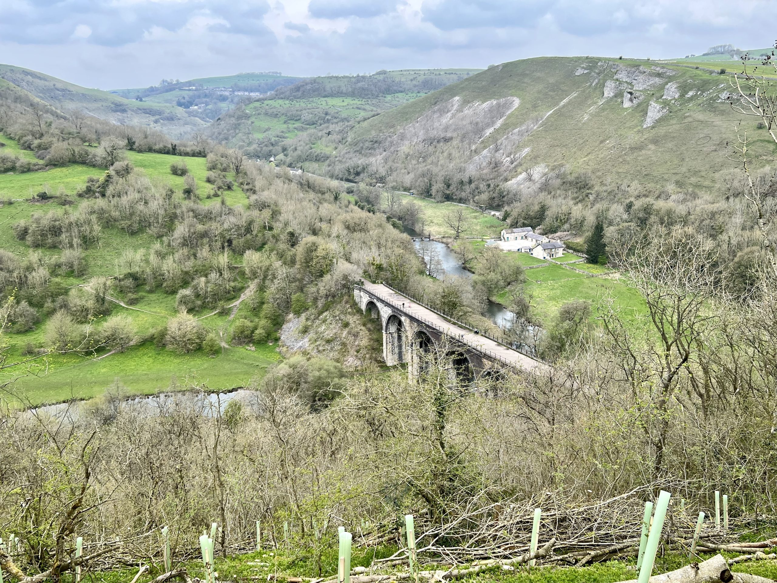
Choose the Monsal Trail if tunnels and limestone-dale views are the attraction. Consider the Tissington Trail for a longer railway corridor you can shorten to suit your run. On the High Peak Trail, choose the section first: its steep inclines make the full route a different proposition from an easy outing on an upper stretch.
Featured photograph: Monsal Head Viaduct by Andrew Abbott, 22 April 2023, CC BY-SA 2.0. Resized for display.

Table of Contents
ToggleCompare the part you will actually run
All three follow former railway routes, but a railway origin does not promise an entirely level run. Your approach from the car park, the direction you set off and the point where you turn back can change the outing considerably.
| Trail | Published whole-trail length, one way | Check before choosing |
|---|---|---|
| Monsal | 8.5 miles, roughly 13.7km | Tunnel passages, daylight and the access route from your chosen start. |
| Tissington | 13 miles in the National Park description | The exact section and surface; the Mappleton incline matters near the Ashbourne end. |
| High Peak | 17.5 miles in the County Council description | Where the steep inclines fall relative to your start and return. |
These are published route descriptions, checked on 27 October 2026, rather than our GPS measurements. Sources: Monsal Trail, Tissington Trail and High Peak Trail. The National Park gives High Peak as 17 miles, while Walk Wheel Cycle Trust lists Tissington as 13.2 miles. Use those lengths as approximate guides and map out your chosen section.
For a relaxed first outing, plan a short out-and-back on the railway line. Adding a valley-floor footpath to make a loop changes the surface, climbing and navigation; assess that loop separately.
Monsal: choose it for viaducts and tunnel passages
The National Park leaflet places the trail between Blackwell Mill and Coombs Road, Bakewell. It passes through limestone dales and crosses the Headstone Viaduct. Former stations give you useful places to join the route without committing to its entire length.
A tunnel interrupts both your view and your running rhythm. Be ready to ease down for people ahead, look at the ground and keep a predictable line. If your idea of a good run is an uninterrupted open-air view, read the tunnel information before making this your first choice.
For straightforward access, look at Hassop or Millers Dale station before choosing a car park solely for the famous view at Monsal Head. The latter involves a steep approach to the trail. Our Monsal running guide works through access, daylight and shorter return options.
Tissington: plan a section rather than chasing the endpoint
The National Park describes a 13-mile route between Ashbourne and Parsley Hay. Walk Wheel Cycle Trust identifies firm unsealed, asphalt and loose unsealed surfaces, and singles out a relatively steep incline at Mappleton.
This is the option to investigate if you want a straightforward railway-trail outing and can be happy turning back before the far end. Choose an access point near the section you want to see, then set a modest return distance. You do not need to turn a scenic run into a one-way transport problem.
Match footwear to the actual surface and conditions you find. A loose or wet stretch may call for a different pace from your familiar paved loop. Test the first few minutes before settling into the effort you planned.
Use the High Peak and Tissington trail map to locate access points and the connection at Parsley Hay. Check current facilities separately; a symbol on an older leaflet does not establish today’s opening hours.
High Peak: the inclines change the choice
Derbyshire County Council describes 17.5 miles from High Peak Junction near Cromford to Dowlow, with a connection to Tissington at Parsley Hay. Its advice for cyclists and horse riders highlights the stretch west of Middleton Top as a way to avoid the steep inclines. Runners should locate the inclines on the map before choosing their start and direction.
Choose a section away from the marked inclines if you mainly want steady running and views. If climbing is the attraction, include an incline deliberately and allow for the descent on your return. An uphill turnaround reverses the task; the return is not simply the same effort again.
Do not use the full High Peak distance to decide whether it is harder than the other two trails. A short run that includes an incline can ask more of your legs than a longer, more even section elsewhere.
Count the return before you set off
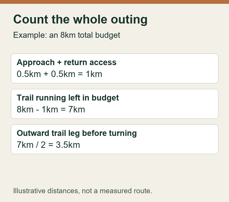
If you want a total outing of about 8km and your access walk is 500m each way, that leaves about 7km for the railway trail: turn after roughly 3.5km along it. Going 4km out along the trail would already use the full 8km before either approach walk.
The same applies to a time budget. An outward 25 minutes is not a promise of a 50-minute outing if you have stopped for photographs, climbed on the way out or still have to get back up an access path. Leave room for the return you actually face.
For a one-way run, establish the return transport before leaving the start. Read the current service and last departure rather than relying on a bus number printed in an old trail leaflet.
Make the outing fit the day
Check the National Park’s temporary-closures page, the relevant trail page and signs at your access point before setting off. At our October check, the notices included upcoming toilet works at Parsley Hay; facilities and the trail itself are separate things to confirm. Bring what you need for the planned distance rather than relying on a café or toilet being open.
These are shared routes. The local Share with Care code asks everyone to keep left and avoid spreading groups across the trail. Leave room for people to pass, slow before an overtake and give horses space; keep any dog under the required control. A busy stretch is a place to ease the run, not squeeze through a gap to preserve your pace.
If you would rather choose an organised hill event, our first fell-race comparison examines terrain, descending and navigation demands. For these railway trails, choose your start, direction and turnaround on the official map, then check that the approach and return fit your day.