The field guide · Scenic forest running
Delamere or Whinlatter for a forest run? Choose the route, not just the distance
By James Thompson · Updated 31 October 2026
Some links in my articles are affiliate links. I may earn a commission when you buy through them.
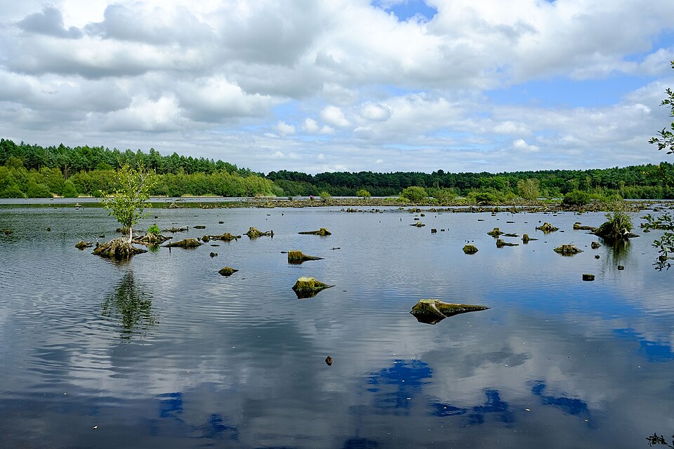
Choose Delamere if you want forest-road and surfaced-trail running around Blakemere Moss, with several shorter options. Choose a Whinlatter route when climbing through a mountain forest is part of the attraction—but check which route and which parts are open before travelling.
Neither forest has a single difficulty level. Whinlatter has two quite different 5km routes, while a Delamere outing can change when you add a hill or leave the advertised running route. This comparison uses Forestry England’s route descriptions and access notices checked on 31 October 2026.
Featured photograph: Blakemere Moss, Delamere Forest by Jeff Buck, 6 August 2020, CC BY-SA 2.0. Resized for display.

Table of Contents
ToggleCompare routes you would actually run
Start with the outing rather than the forest name. Choose a route length, look at the ground and climbs, then work out where you will join and finish. These are published route lengths, not our GPS measurements or a ranking of all UK trails.
| Option | Published route character | Good reason to investigate it |
|---|---|---|
| Delamere · short options and 5km | The running guide offers turnaround plaques for 1km, 2km and 3km; a white-marked 5km shortcut and the 5km Blakemere trail are other options. | You want a shorter forest outing without committing to the full 10km. |
| Delamere · 10km | Forest roads and surfaced trails; a route beside the railway and around Blakemere Moss. | You want woodland and waterside scenery on a longer marked route. |
| Whinlatter · brown 2.5km/4km | Undulating running around Revelin Moss; the optional extension adds climbing around Sanderson Gill. | You want to sample the forest before choosing a longer hillier route. |
| Whinlatter · turquoise 5km | A south-side route with hills described as shorter and less steep than the pink 5km. | You want a 5km with climbing, while avoiding the more demanding pink profile. |
| Whinlatter · 10km | A circular route with two substantial climbs and travel through both sides of the forest. | You want a longer outing with repeated climbing and have checked the current diversion. |
Sources: Delamere running routes, Whinlatter brown routes, turquoise 5km and 10km route. The table describes the routes; access can change separately.
Delamere: woodland and waterside running on surfaced routes
Forestry England describes the running-trail surfaces as forest road or surfaced trail. That makes Delamere a useful place to investigate when you want to try a forest run without deliberately choosing rough hillside ground. It does not establish that every path in the forest is level, dry or part of the running route.
The full purple-marked 10km follows the railway-side trails, circles Blakemere Moss and returns via the picnic area. If seeing the water is your main aim, also look at the 5km Blakemere trail. It starts by the café, uses yellow markers and is shared with cyclists.
Keep the two 5km descriptions clear: the running page also offers a white-marked shortcut on the 10km. Yellow Blakemere and the white shortcut are named options, not a colour code you can apply to any sign you find. Choose the intended route on the operator’s map before setting off.
For a relaxed outing, leave room to pause by the Moss and let others pass. A distance target that requires threading through walkers or holding road pace on a wet bend will make a scenic run less enjoyable.
Whinlatter: decide how much climbing you want
Whinlatter’s brown 2.5km route is described as gently undulating, with a 4km extension that adds a climb around Sanderson Gill. It gives you a shorter option to consider without assuming that “mountain forest” means every outing must be long or strenuous.
The two 5km routes need a closer look. The turquoise route has shorter, less steep hills than the pink route in Forestry England’s comparison. The pink profile describes a climb towards Bob’s Seat, an extra small loop at the top and a long descent, mostly on wide forest roads with a short forest-path section. Equal distance leaves plenty of room for different effort.
On the 10km, the descent after the first climb is followed by another substantial climb in the south of the forest. Do not spend all your energy on the first uphill and treat the next downhill as the start of the finish. Allow for the second climb when choosing your effort and time budget.
Separate climbing, footing and navigation
A wide forest road can still be a hard uphill run. Conversely, a shorter trail may demand more attention to footing even when it gains little height. Use the route description for those separate questions; a single “easy” or “hard” label hides the choice you need to make.
Waymarks help you follow a chosen route, but forest junctions can offer signs for walking, cycling and running. Keep the full route name and distance alongside its colour, identify the start on the official map and check where you will notice a wrong turn.
Check access before committing to the journey
Whinlatter’s current operations notice is essential reading alongside its route pages. The update dated 26 October lists different access states for the brown, turquoise, pink and longer routes. A permanent description of a circular trail does not establish that its normal start or full circuit is available today. The Whinlatter route and diversion guide explains how to keep those checks together.
At Delamere, the roadworks notice concerns approaches to the forest as well as your trail choice. It lists an Abbey Lane closure at Chester Road from August 2026 to March 2027. Check the current diversion before relying on your usual drive; an open forest does not mean every approach road is open.
Delamere has a railway station at the forest, according to its visitor information. Check a current journey planner and allow time between the station and your chosen route start. At either forest, confirm parking arrangements, gate times and facilities for the day rather than relying on an old map symbol.
Choose a modest first loop and keep the return simple
If you are new to the area, pick one named route you can finish comfortably, rather than joining several colours to reach a round distance. Check the return to your actual transport point before adding an extension. A climb or diversion late in the outing can use more time than another flat kilometre would.
Use the first few minutes to assess the ground and your effort. Walk an uphill if that keeps the outing comfortable, and allow time for the descent rather than assuming it will make up the climb. Follow closures and signed diversions; an apparently short connecting track may lead into the work area.
If you would prefer a railway corridor with a clear turnaround instead, the Monsal, Tissington and High Peak comparison gives you a different scenic-running option.